
1.1
Selonia on different maps
The Daugava connects different pictures of Selonia’s past.
The history edited by Šapoka in 1936 places the Selonians along the left bank of the middle Daugava. It links a large part of them with the Lithuanian state. S6
Gimbutienė attributes burial mounds on both banks of the middle Daugava to the Selonians. At Luokstenė she describes eight log houses, a jeweller’s workshop and a smithy. Cultural continuity informs her suggestion of early Selonian settlement. S11
Andra Simniškytė distinguishes Daugava Selonia from its inland, southern part. In her study, these were settlement networks with different histories, later drawn towards Livonia and the Grand Duchy of Lithuania. Today’s state border does not reproduce that earlier structure. S172
1.2
Whom do we call Selonians?
Researchers do not always mean the same thing by this name.
In her study of Selonian–Lithuanian contacts, Simniškytė deliberately uses “Selonians” geographically, for historical Selonia, without defining its inhabitants’ ethnicity. S173
Vytautas Kardelis notes that evidence for Selonian is chiefly names. He questions whether traditional sound criteria establish poorly attested Baltic varieties as separate languages. A people’s name alone does not prove a distinct language. S166
1.3
Excavated sites and tentative assignments
An archaeological map also reflects how many sites have been investigated.
In 2000, Vytautas Kazakevičius assigned more than 55 archaeological sites to Lithuanian Selonia. Only 18 had been investigated more extensively. Several assignments were provisional: without excavation, the affiliation of a hillfort or burial ground remained uncertain. S171
Simniškytė examines how hillforts, settlements at their feet and burial grounds cluster together. These relationships suggest centres and their surrounding areas. In her assessment, a similar place-name alone is insufficient to identify a historical location. S172
1.4
A fortified hill and the settlement below
At Juodonys, the hilltop is only part of the story.
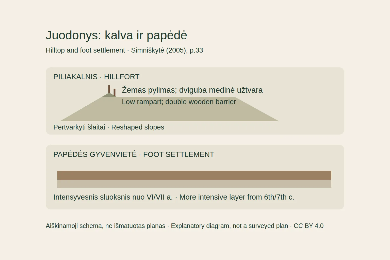
The research discussed by Simniškytė indicates that Juodonys’s slopes were steepened in the third quarter of the first millennium. A rampart roughly 2.5–3 m wide and 0.6 m high carried double wooden barriers above, strengthening the hill’s defences. S172
Below the hill lay a rich layer left by intensive settlement activity. Reinvestigation and radiocarbon dating placed its beginning around the sixth or seventh century. This dates a stronger phase of occupation, rather than the first human presence beside the hill. S172
The hill and its foot settlement are examined together. Defences above and denser traces of activity below help explain changes in the complex as a whole. Simniškytė places these developments within her broader model of Selonia’s settlement hierarchy. S172
Based on: S172
1.5
Houses on damp ground
Posts, clay and birch bark preserved at Dignāja reveal how houses were built.
The Dignāja settlement of the later first millennium occupied damp ground. Simniškytė reports surviving posts and layers of clay and birch bark used against moisture. Its inhabitants adapted their buildings to the ground beneath them. S172
The account describes houses measuring about 3 × 4 m and heating structures made with stone and clay. The remains reveal building materials and modest floor areas. The complete houses, their roofs and furnishings remain unknown. S172
Slag also points to iron production and working. Houses, heating structures and manufacturing debris reveal activities taking place side by side, though the function of individual buildings cannot always be established. S172
Based on: S172
1.6
More than trade sustained a settlement
Small traces of activity also help explain the surroundings of hillforts.
Alongside tools and pottery, Simniškytė draws on pollen evidence. It points towards cultivated fields, while manufacturing debris records work within settlements. Together these traces reveal connections between farming and crafts. S172
The centres emerging around the sixth or seventh century are linked in her study to concentrated activity and settlements with differing roles. For Simniškytė, this hierarchy does not yet amount to an integrated political and administrative state. Larger complexes could develop without a single authority governing all Selonia. S172
Based on: S172
1.7
Two bracelets and wider connections
A small find allows objects from different places to be compared.
A surface survey at the foot of Kereliai hillfort in 2001 found two connected bronze bracelets. Simniškytė describes their convex, slightly widening bands and net ornament. She compares them with tenth-century material from eastern Latvia. S172
The comparison supports discussion of distribution and possible production links. The bracelets were nevertheless surface finds, rather than objects from a sealed workshop deposit. They reveal neither a particular owner nor the journey that brought them to Kereliai. S172
Based on: S172
1.8
Scales below the hillfort
At Stupeļi, traces of exchange and crafts accompany the fortifications.
Simniškytė dates the late hillfort horizon at Stupeļi to the tenth through twelfth or thirteenth centuries. Timber structures were reinforced with layers of stone, and hearth or oven remains survived. This phase is distinguished from earlier occupation and a lengthy hiatus. S172
The foot settlement yielded tools, ornaments, metal raw materials and manufacturing traces. Simniškytė regards the scales and weights as important evidence for trade. She associates the combined finds with a centre of crafts and exchange. S172
Manufacturing and weighing equipment found together help explain Stupeļi’s importance within its settlement network. They suggest the kinds of work undertaken, while preserving no particular market day, named merchants or individual transactions. S172
Based on: S172
1.9
Was Sēlpils the capital of all Selonia?
The chronicle’s best-known castle need not have governed the entire region.
Simniškytė challenges the traditional picture of Sēlpils as the capital of all Selonia. In her model, it was an important Daugava-area centre. She turns to Stupeļi when considering the political importance of inland Selonia. S172
Her comparison draws on settlement size, relative location and archaeological evidence. The hierarchy of centres she proposes cannot simply be equated with state administration. Stupeļi remains a possible inland centre, rather than the established capital of a unified state. S172
Based on: S172
1.10
Similar mounds, different histories
Burial mounds are a major feature of Selonia’s archaeology.
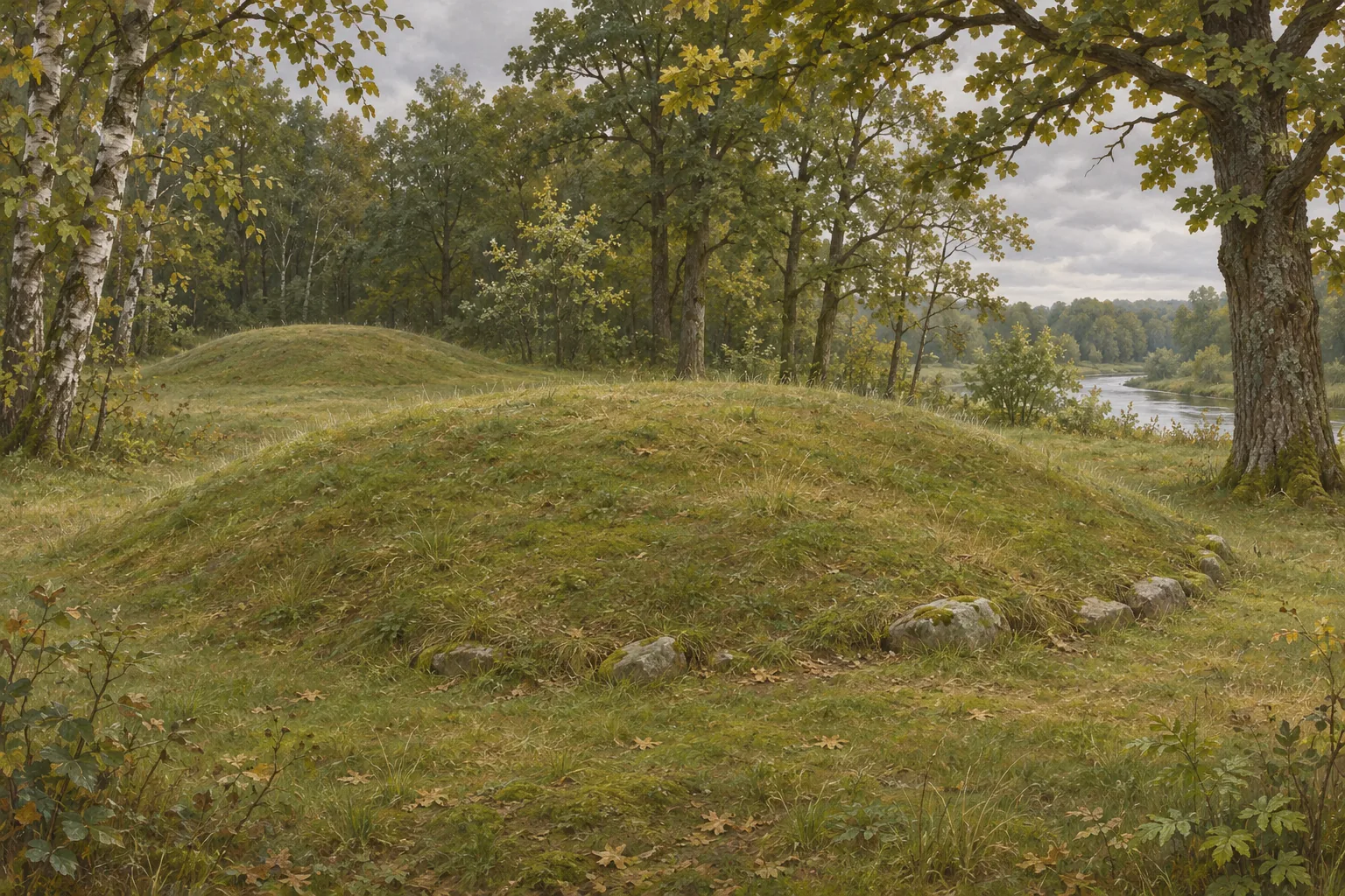
Kazakevičius describes the early culture of stone-kerbed burial mounds as extending beyond the territory later identified as Selonia. Regional groups developed within that wider area over time. An early mound edged with stones therefore does not establish a Selonian identity by itself. S171
In his synthesis, burial of several people within mounds persisted longer in the south, while flat cemeteries became more widespread in the north. These are broad tendencies, rather than a simultaneous rule everywhere. Similar mound forms and gaps in excavation prevent a single precise boundary from being drawn. S171
Based on: S171
1.11
Fifteen excavated mounds
The Visėtiškės excavation report moves from the broad map to counted graves.
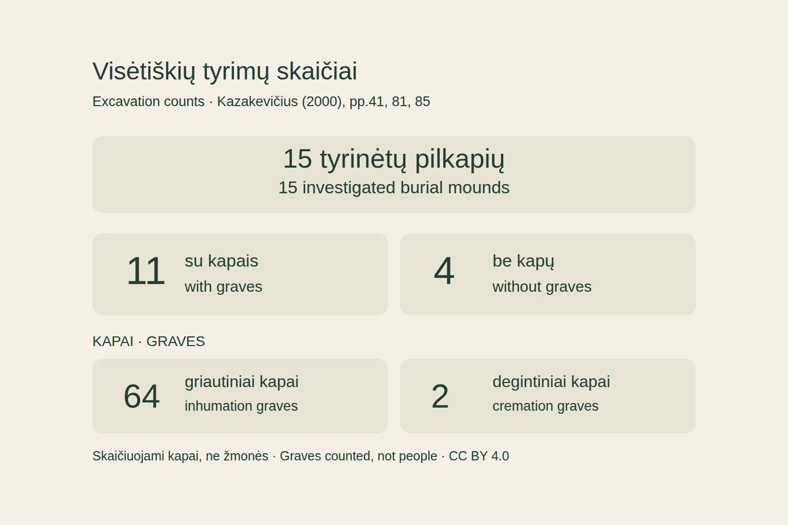
Kazakevičius published findings from 15 excavated mounds at Visėtiškės. Eleven contained 64 inhumation graves and two cremation graves; four yielded no graves. These are counts of graves, rather than a census of everyone who lived or was buried here. S174
The report distinguishes groups of mounds. Mounds I–VIII lacked stone kerbs and contained few graves or none. Kerbs and multiple inhumations were more prominent in the other group; the stones often formed discontinuous arrangements rather than perfect circles. S174
The main text, table and opening of the English summary agree on these counts. A later passage in that summary nevertheless gives a conflicting figure of 56. The figures used here follow the explicit breakdown of 64 inhumation and two cremation graves. S174
Based on: S174
1.12
When burial was most intensive
Kazakevičius builds the Visėtiškės chronology through comparisons of artefact types.
The main report places the most intensive use of the cemetery in the eighth to early eleventh centuries, with graves continuing into the twelfth. The earliest component remains uncertain. This lengthy sequence rules out treating all the mounds as the burials of a single generation. S174
Excavations began in 1985. The publication gives differing end dates, 1988 and 1989. These are excavation dates, not burial dates. Kazakevičius assigns the cemetery to the Selonians through archaeological interpretation, rather than a name its inhabitants left in a grave. S174
Based on: S174
1.13
A small find from mound X
The whorl’s dimensions are better known than the story of its owner.
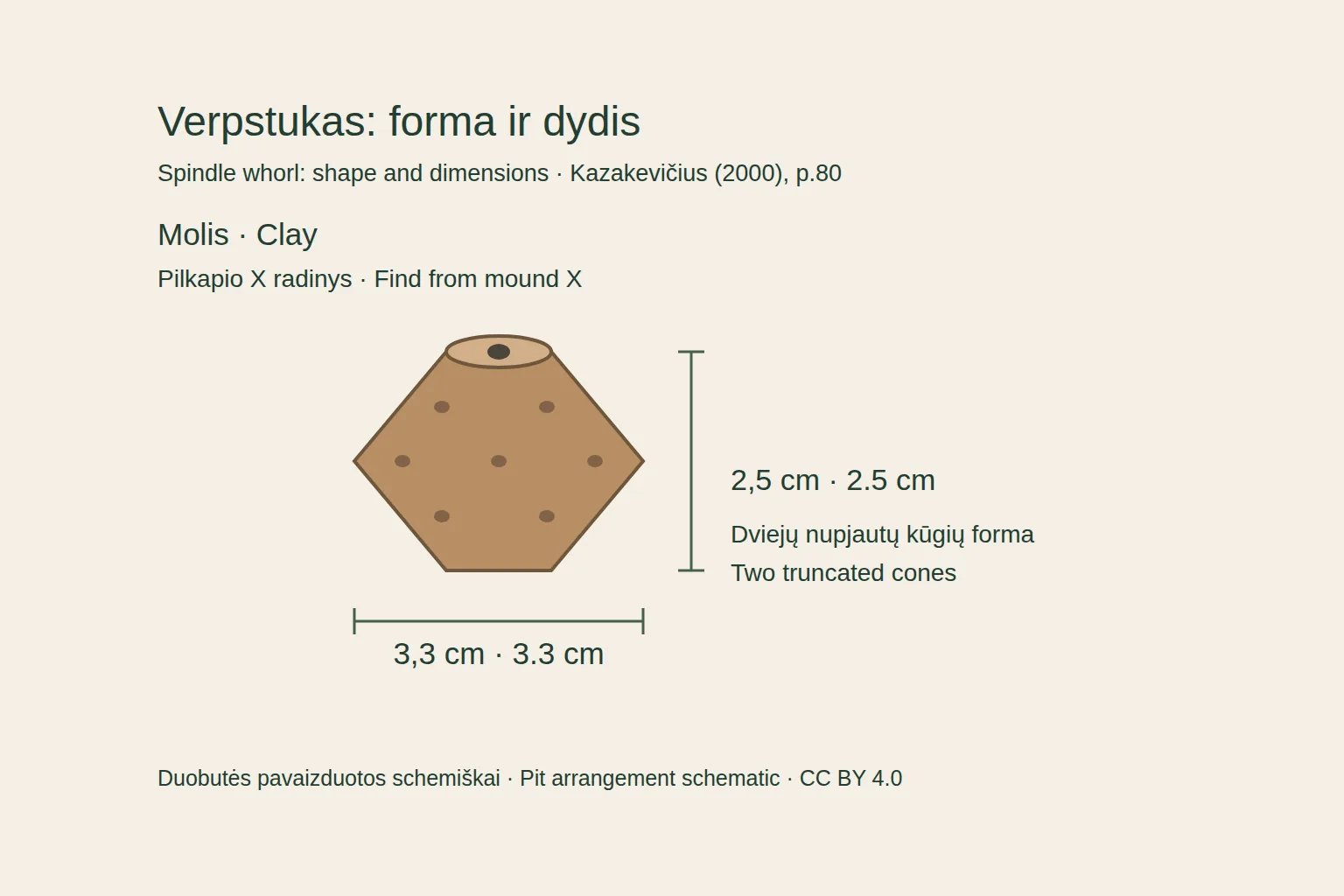
Mound X yielded a clay spindle whorl shaped like two truncated cones joined together. Kazakevičius records a diameter of 3.3 cm, a height of 2.5 cm and impressed pits. Its broad eighth- to eleventh-century date follows the mound’s chronology. S174
The whorl was a loose find within the mound, unconnected to a particular sealed grave. Its owner and that person’s clothing remain unknown. The accompanying diagram explains its shape and measurements; the arrangement of pits is schematic. S174
Based on: S174
1.14
Henry’s view of the Daugava
In the written account, the castle appears during warfare.
Henry of Livonia presents the expedition against the Selonian castle as the bishop’s defence of his church against pagans. In his account, the castle shelters Lithuanians heading out on raids and returning from them. This is the Christian chronicler’s explanation for the military expedition. S175
The chronicle calls it the castle of the Selonians. In a footnote, the 1874 editor Wilhelm Arndt identifies it with Selburg, or Sēlpils, on the Daugava. Simniškytė’s 2005 study dates the taking of the castle and the baptism of its inhabitants to 1208. S175 S172
1.15
A mixed force crosses the river
The participants named by Henry were more than the army of a single order.
The bishop sends Abbot Theoderic and Provost Engelbert, men of his household and pilgrims. The Brothers of the Militia of Christ, known as the Sword Brothers, join them. At the episode’s end, Henry also names Latgalians and Livonians among those returning. S175
The force moves towards Aizkraukle, crosses the Daugava and reaches the castle. Henry describes the direction of the expedition without leaving a precise plan of the fighting. He names neither a Selonian commander nor a total number of defenders. S175
Based on: S175
1.16
Warfare reaches the villages
In Henry’s narrative, the siege also reaches people outside the castle.
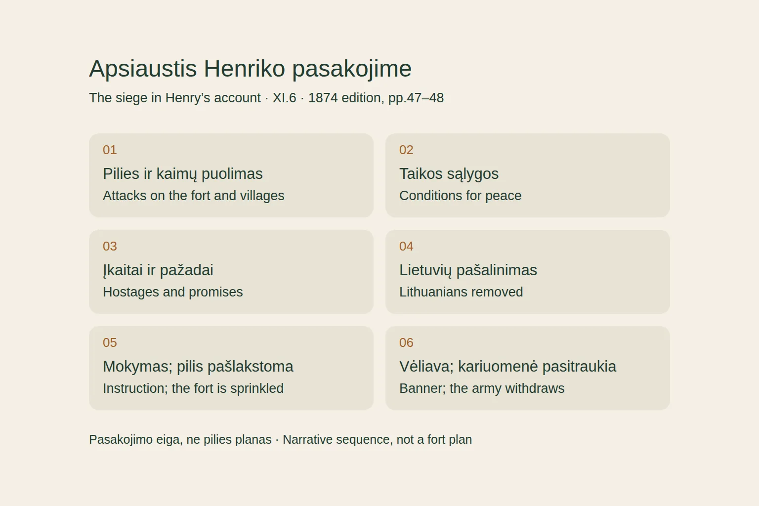
The attackers surround the stronghold and wound defenders with arrows. In the villages they take some people captive and kill others. The chronicle thus describes violence in settlements as well as fighting around the castle. S175
The besiegers carry wood together and build a great fire. Henry stresses that the defenders receive no rest by day or night. He does not state how many days the siege lasted or establish that the entire castle burned down. S175
Based on: S175
1.17
Hostages, a promise of baptism and withdrawal
Peace is sought under the pressure of siege.
The frightened Selonians, Henry says, secretly summon the army’s elders and ask for peace. The conditions are to abandon what the chronicler calls idolatry, receive Christ and baptism, and remove the Lithuanians from the castle. S175
The Selonians give hostages, promise baptism and obedience, and remove the Lithuanians. The army is appeased on receiving their children, called pueri in the Latin text. Henry gives no names, number or later fate for them. S175
The clergy ascend to the castle, teach the beginnings of the faith, sprinkle the castle with holy water and raise Mary’s banner. Henry celebrates the church’s growth, and the army withdraws. The account explicitly describes a promise of baptism and the sprinkling of the castle, rather than a mass baptism of all inhabitants. S175
Based on: S175
1.18
The Selonian name continues after the siege
Later episodes bring Selonians back into the chronicle.
In another episode, after Koknese is burned and its ruler departs, Latgalians and Selonians living there seek refuge in the forest. Henry also describes pursuit, seizure of property and the killing of people he considers accomplices in betrayal. The justification of this violence belongs to the chronicler. S175
In the section for 1213, warriors from Koknese and Letts again ravage Selonian and Lithuanian lands, plundering, killing and taking captives. This notice places Selonian communities within continuing conflicts. Peace at one castle had not ended the region’s history. S175
Based on: S175
1.19
Selonia among larger powers
Later chronicle passages and the archaeological model suggest differing regional trajectories.
Later Henry describes the papal legate addressing Germans, Rus’, Letts and Selonians living together at Koknese. The Germans are warned against excessive burdens and undue exactions on their subjects. Christian teaching and customs are urged alongside the abandonment of pagan rites. The admonition does not establish that it was enforced. S175
In Simniškytė’s interpretation, Daugava and southern Selonia followed different paths. Their incorporation into Livonia and the Grand Duchy of Lithuania built on differing settlement histories and geographical connections. The Sēlpils account cannot encompass the fortunes of every Selonian community. S172
1.20
The hill at Velikuškiai in later memory
Later recorded stories also became part of the hills’ remembered past.
A legend recorded at Zarasai in 1925 tells of a manor that sank into the ground at Velikuškiai and a bridge broken by giants. It is a local telling, not testimony to an event or belief among ancient Selonians. S13
Selonia’s past leaves different traces side by side: settlement layers, grave finds and events selected by a chronicler. Kazakevičius called for archaeology, history and linguistics to be studied together. That work leaves room for new discoveries and different interpretations of evidence already known. S171 S175